Unlocking Urban Potential: The Egypt Data Foundation
We provide clients with the most detailed and comprehensive urban geospatial dataset available, transforming vast cities into manageable, addressable assets. Our work in Egypt is a prime example of a complete urban data foundation built for precision and commerce.
Data at Scale and Detail:
We go beyond simple locations. Our team meticulously surveyed and integrated over 200,000 Points of Interest (POIs) into the dataset. Each POI is enriched with essential business information, making the data invaluable for e-commerce, navigation, and service delivery:
We provide clients with the most detailed and comprehensive urban geospatial dataset available, transforming vast cities into manageable, addressable assets. Our work in Egypt is a prime example of a complete urban data foundation built for precision and commerce.
Data at Scale and Detail:
- Network-Ready Streets: We created a detailed, network-friendly street network, optimized for routing, logistics, and network analysis.
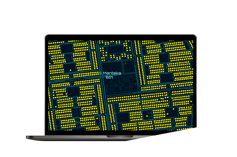
- Super-Detailed Base Map: Our maps include full-fidelity data on landmark polygons, landscape features, and building footprints , providing a rich context for all urban planning and development.
- Precision Addressing: We have accurately mapped over 2.6 million address points, ensuring every building is locatable and service-ready.
We go beyond simple locations. Our team meticulously surveyed and integrated over 200,000 Points of Interest (POIs) into the dataset. Each POI is enriched with essential business information, making the data invaluable for e-commerce, navigation, and service delivery:
- Full Contact Details
- POI Type and Subtype Classification
- Active Social Media Links